

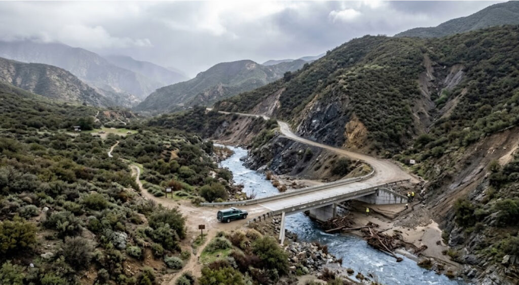
Southern California’s national forests are entering a new phase of recreation infrastructure planning as the U.S. Forest Service prepares roads, bridges, trails and recreation sites for a wider range of climate-related hazards. A September 14, 2026 Forest Service research release identifies extreme precipitation, atmospheric rivers, flooding, landslides, wildfire, drought and changing temperatures as growing pressures on recreation infrastructure across the Angeles, Cleveland, Los Padres and San Bernardino national forests.
The issue is particularly important in Southern California because these forests sit close to some of the country’s largest population centers. Together, the four national forests cover approximately 3.5 million acres across 10 counties, extending from the Los Padres landscape near Monterey County to the Cleveland National Forest near the Mexico border. They provide hiking, camping, skiing, fishing, boating, off-road recreation and scenic driving opportunities for millions of people.
The Forest Service’s latest assessment does not describe infrastructure resilience as a future-only concern. It identifies roads, trails, bridges, campgrounds and trailheads as assets already exposed to changing weather patterns. A new bridge over Trabuco Creek in the Cleveland National Forest, for example, has been designed to withstand flooding and debris flows, illustrating how engineering decisions are beginning to change in response to the risks identified by researchers.
Four National Forests Face A Shared Infrastructure Problem
The Southern California assessment covers four national forests with very different landscapes but a common dependence on recreation infrastructure.
The Angeles National Forest encompasses the San Gabriel and San Bernardino mountain systems immediately north and east of the Los Angeles metropolitan area. The Cleveland National Forest stretches across mountain landscapes in San Diego, Riverside and Orange counties. The San Bernardino National Forest includes destinations around Big Bear and the San Bernardino Mountains, while the much larger Los Padres National Forest extends along the Central Coast and inland mountain ranges.
These forests are especially important because they provide relatively close access to outdoor recreation for a huge urban population. Researchers point to locations such as Mount Wilson Observatory, San Gorgonio Mountain and the Big Sur coast as examples of destinations whose popularity can increase as temperatures rise in surrounding urban areas.
That growing demand places additional pressure on infrastructure that already has maintenance needs.
The Forest Service research identifies extreme precipitation as one of the central threats. More frequent or intense atmospheric-river events can overwhelm drainage systems, damage roads and destabilize slopes. When culverts, drainage channels, bridges or trail crossings fail, the result can be much more than a temporary inconvenience. A damaged road can isolate a campground, while a destroyed bridge can eliminate access to a trail system or recreation destination.
For ITPR readers following the relationship between public recreation and infrastructure resilience, ITPR recreation resilience reporting provides a broader perspective on how agencies are adapting outdoor destinations to changing physical conditions.
Atmospheric Rivers Are Changing The Engineering Equation
Southern California’s relationship with heavy rainfall is particularly complicated.
The region is generally associated with drought and wildfire, but winter storms can produce extremely concentrated rainfall. Atmospheric rivers can move large volumes of moisture into the region over relatively short periods, placing enormous pressure on mountain drainage systems.
The Forest Service’s latest assessment states that extreme precipitation events are expected to increase under future climate conditions and warns that atmospheric rivers can stress critical drainage features. When drainage systems fail, roads and trails can experience severe erosion and structural damage.
This changes how recreation infrastructure has to be designed.
Historically, an engineer could use past rainfall and streamflow patterns to establish design parameters for a bridge or road crossing. A changing hydrological environment makes that historical baseline less reliable. The Forest Service says managers can use projections of future hydrology and flood regimes to design more resilient roads and bridges.
The implication is significant: infrastructure projects increasingly have to account for the conditions that may exist decades after construction, rather than simply replacing an old structure with a similar one.
| Infrastructure Risk | Potential Recreation Impact |
|---|---|
| Extreme precipitation | Road, bridge and trail damage |
| Atmospheric rivers | Drainage-system failure and flooding |
| Landslides | Road and trail closures |
| Wildfire | Burned infrastructure and hazardous trees |
| Drought | Reduced water availability and altered recreation |
| Extreme heat | Visitor safety concerns and changing recreation patterns |
The Forest Service’s approach is therefore less about building bigger structures everywhere and more about identifying where infrastructure is most exposed and adapting engineering decisions to local conditions.
The Trabuco Creek Bridge Shows What Adaptation Looks Like
One of the clearest examples is found in the Cleveland National Forest, where the Forest Service highlighted a new bridge over Trabuco Creek.
The bridge is specifically designed to withstand flooding and debris flows, according to the September 14 research release. Its inclusion in the Forest Service’s resilience discussion is important because it turns a broad climate-risk assessment into a visible piece of recreation infrastructure.
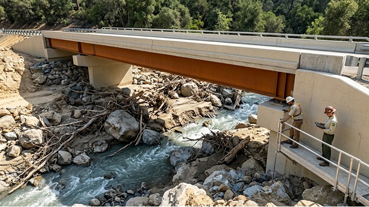
Trabuco Canyon has a long history of recreation use. Earlier Forest Service environmental documentation describes the area as receiving heavy use from hikers, mountain bikers, horseback riders and visitors driving into the forest. The canyon also contains multiple stream crossings and has experienced problems involving clogged culverts, erosion and flooding.
The creek’s infrastructure has historically had to perform several functions at once. It must allow vehicles and recreationists to cross the drainage while also managing water movement through a steep mountain environment.
That becomes increasingly difficult when large storms produce rapid changes in streamflow.
The older Forest Service environmental assessment noted that some Trabuco Canyon crossings could become clogged with debris, causing water to back up and eventually flood across the road surface. Flooding also contributed to erosion along and within the roadbed.
The new bridge therefore represents more than a replacement structure. It is an example of how recreation infrastructure can be redesigned around the physical behavior of the landscape rather than treating extreme weather as an unusual event.
Recreation Roads Are Often The First Point Of Failure
Visitors generally think about trails when they think about outdoor recreation, but roads are often just as important.
A hiking destination can remain physically intact while becoming inaccessible because the road leading to the trailhead has failed. The Forest Service’s Southern California research specifically identifies roads and other infrastructure as vulnerable to extreme precipitation, landslides and wildfire.
This creates a cascading effect.
A road closure can prevent visitors from reaching campgrounds, trailheads and scenic areas. If a road remains closed for months, businesses that depend on recreational traffic can also be affected. When a bridge fails, the impact can extend beyond the immediate crossing because the structure may provide the only practical connection between a developed recreation site and the regional road network.
Forest Service research on recreation displacement reinforces this point. A survey of 3,585 Southern California residents who had visited one of the four national forests since summer 2020 found that road closures and extreme heat were the two most common drivers of recreation displacement resulting in a change of plans.
That finding puts infrastructure reliability into a visitor-management context.
A damaged road does not simply affect transportation. It changes where people recreate, how far they travel and whether they participate at all.
Wildfire And Flooding Can Compound Each Other
Flood risk in Southern California cannot be considered separately from wildfire.
After a major fire, vegetation cover can be reduced, soils can become less stable and slopes can become more susceptible to erosion. Heavy rainfall arriving after a fire can therefore produce a different landscape response than the same rainfall would have generated before the fire.
The Forest Service’s recreation-displacement research identifies wildfire as a major source of long-term disruption because large fires can destroy trail and campground infrastructure while also leaving burned trees that create safety hazards for visitors.
The four Southern California national forests already contain extensive areas where wildfire has altered the recreation landscape.
In January 2026, Forest Service researchers released interactive maps identifying areas with elevated potential for long-term recreation displacement following wildfire across the Angeles, Cleveland, Los Padres and San Bernardino national forests. The maps allow managers to examine individual roads, trails and recreation sites and identify infrastructure that may face prolonged disruption.
That mapping approach is important because infrastructure planning increasingly depends on understanding multiple hazards simultaneously.
A bridge may be exposed to flooding during winter storms, falling trees after wildfire and increased debris movement after a burn. A campground near a stream may face flood risk while also becoming more vulnerable to extreme heat and reduced water availability.
The infrastructure problem is therefore becoming multidimensional.
Drought Creates A Different Kind Of Recreation Infrastructure Risk
Flooding is one side of the equation. Drought creates another.
Southern California’s forests support water-dependent recreation, but the latest Forest Service assessment warns that drought can reduce precipitation and fresh-water availability. Lower water levels can affect lakes, streams and other recreation features while also creating challenges for backpackers who depend on reliable water sources.
The Forest Service’s recent visitor research provides an indication of how those changes may influence recreation decisions.
Researchers conducted a discrete-choice study examining how visitors responded to wildfire- and drought-related displacement scenarios. The study found that visitor preferences changed depending on the type of disruption, with some groups showing preferences for different travel distances, trail difficulty and environmental features.
This matters for infrastructure planning because managers cannot assume that replacing a damaged facility automatically restores the same recreational experience.
If a water body becomes unreliable, visitors may move to another destination. If a trailhead becomes inaccessible, demand may shift to a nearby site. If that alternative site lacks adequate parking, restrooms or trail capacity, the original disruption can create secondary pressure somewhere else.
Popularity Is Increasing The Pressure On Existing Infrastructure
Southern California’s recreation infrastructure faces another challenge: demand.
The Forest Service expects some mountain and coastal recreation destinations to become increasingly popular as surrounding communities experience higher temperatures. Outdoor recreation provides a natural escape from urban heat, making nearby forests particularly important during hot periods.
But increased visitation can place more stress on roads, parking areas, restrooms, trails and bridges.
That creates a difficult management balance. Agencies have to preserve public access while also preventing infrastructure from being overwhelmed.
The problem becomes more acute when extreme weather occurs during periods of high visitation. A road or bridge failure can affect thousands of people, while a trail damaged during a storm may remain closed until crews can safely inspect and repair the route.
The Forest Service’s research therefore connects climate risk with visitor demand rather than treating them as separate management issues.
Recreation Infrastructure Is Becoming A Climate-Adaptation Tool
The most important shift described in the Forest Service research is the movement from reactive repairs toward forward-looking adaptation.
Instead of rebuilding every road, bridge or trail to its previous specifications, managers can evaluate projected flood regimes, changing precipitation patterns, wildfire exposure and future recreation demand before determining how an asset should be rebuilt.
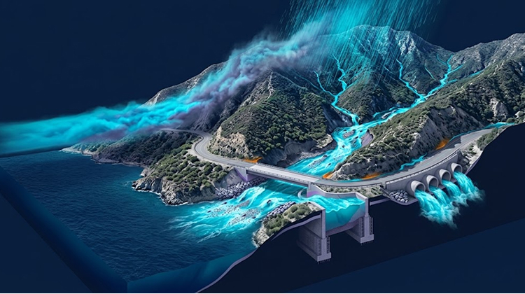
That approach can influence everything from bridge location to drainage capacity.
It can also affect whether an existing recreation facility should be rebuilt in the same location at all.
The Forest Service’s research explicitly identifies infrastructure resilience as part of preserving public benefits from recreation. Roads, trails and bridges are not simply physical assets; they are the systems that allow visitors to reach forests, campgrounds, scenic destinations and wilderness gateways.
This is especially relevant in Southern California, where recreation areas sit close to major population centers and where millions of people depend on relatively short trips to access mountain and coastal landscapes.
The Next Generation Of Forest Recreation Will Require More Flexible Infrastructure
The September 2026 Forest Service research suggests that Southern California’s recreation infrastructure is entering a period in which flexibility will become as important as durability.
A bridge must withstand high flows. A road must tolerate more severe drainage events. A trailhead may need to function despite changing water availability. A campground may require greater protection from flooding or extreme heat. At the same time, infrastructure must remain accessible enough to serve communities that increasingly rely on nearby forests for outdoor recreation.
The challenge is substantial because the four forests cover approximately 3.5 million acres, contain thousands of recreation assets and span dramatically different ecosystems and elevation zones.
There is no single engineering solution that can address all of those environments.
The Trabuco Creek bridge offers one example of a structure designed around flooding and debris flows. The Forest Service’s wildfire-displacement maps provide another layer by identifying recreation sites that could experience prolonged disruption after fires. Scientific research into visitor preferences adds a third dimension by showing where people may go when traditional recreation destinations become unavailable.
Together, these efforts point toward a broader change in how public recreation infrastructure is managed.
The objective is no longer simply to keep roads open and bridges standing under historical conditions. It is to build a recreation network capable of continuing to serve the public as weather, wildfire, water availability and visitation patterns change.
For Southern California’s national forests, that means the bridge over Trabuco Creek is part of a much larger story. Infrastructure that once could be evaluated primarily through age, wear and maintenance requirements now has to be evaluated against the future behavior of the landscape itself.
That shift will determine how effectively the Angeles, Cleveland, Los Padres and San Bernardino national forests can maintain public access while preparing for the increasingly complex conditions surrounding outdoor recreation.