


Corpus Christi Flood Protection moved into a new implementation phase after City Council action on September 8, 2026, with downtown waterfront work, utility improvements and project planning now tied to several official city records. The most immediate change involves up to $13.85 million approved for design and construction of floodwall upgrades near the Corpus Christi Museum of Science and History, according to the City of Corpus Christi’s September 8 announcement on the port partnership approval.
The work described by the city is local in effect but regional in purpose. It concerns flood risk near the Ship Channel, downtown pedestrian connections, port operations and existing seawall systems. As of September 29, 2026, the cited council approvals had already occurred, while construction timing, traffic effects and site-specific access changes remain matters for posted city project notices and future public records.
What Corpus Christi Flood Protection Approved
Corpus Christi Flood Protection Scope
The City of Corpus Christi said the September 8, 2026 approval covered up to $13.85 million for the design and construction of upgrades near the Corpus Christi Museum of Science and History. According to the city announcement, the planned work includes a floodwall, bulkhead and concrete apron along the Ship Channel. The stated purposes are flood protection, improved waterfront pedestrian connections and support for port operations.
The Corpus Christi Flood Protection package is significant because it links a downtown civic and cultural area with ship-channel infrastructure. The museum area sits near public destinations, waterfront movement corridors and port-adjacent facilities. The city’s description indicates that the project is not limited to a single wall segment; it combines vertical flood protection, shoreline support and a hard-surface apron in one work area.
City materials in the research record also identify Project E16319 in the adopted fiscal years 2025-2027 Capital Improvement Plan as “Floodwall Upgrades at Science Museum.” The same research notes state that the project includes floodwall construction and bulkhead extension from the Ship Channel Overlook east of the Harbor Bridge to the existing seawall at the Art Museum of South Texas. That description places the work in a public-facing section of downtown waterfront infrastructure, though the exact construction schedule should be confirmed through current city postings before residents rely on it for access planning.
Sam Rankin Street Utility Work
The September 8 council action also included a $2 million amendment for utility, storm drainage, water, wastewater and gas infrastructure work on Sam Rankin Street, according to the same city announcement. The city said the amendment raised the total for that work to $4.5 million and identified the project limits as Sam Rankin Street from Port Avenue to I-37.
That work is separate from the museum-area floodwall, but the two approvals show how flood, drainage and utility planning are being coordinated in the same period. For downtown and near-downtown residents, the Sam Rankin Street item matters because buried utility work can affect street access, repair timing and future service reliability. The city tied the Sam Rankin investment to Bond 2024 in its announcement.
Downtown Work Areas And Infrastructure Links
September 3 Public Hearing Record
Before the September 8 action, the City initiated a public hearing record for fiscal year 2026-27 project planning under File #26-1421. The Legistar file listed a September 3, 2026 agenda item covering Coastal Parks, North Beach, North Padre Island and Downtown Seawall Systems Analysis and Master Plan; Floodwall Upgrades at the Science Museum; Marina Breakwater; and Marina Bulkheads, according to the official File #26-1421 record.
That record helps residents distinguish between project approval, project planning and future construction. A public hearing item does not mean every listed improvement is already built. It does show which projects were placed before the public process for the fiscal year 2026-27 cycle. Residents tracking property access, construction staging or public-space changes should rely on posted agendas, adopted minutes and department project notices rather than informal timelines.
How Downtown Systems Fit Together
City information in the research record describes downtown flood protection as a system with several named components: the Salt Flats Levee, the Port Authority Wharf and Promenade, the Museum Floodwall, the U.S. Army Corps of Engineers’ bulkhead, city seawall segments and pump stations at Kinney Street and Power Street. The city’s description states that these parts work together against storm surge and urban flooding.
That system-based framing is useful for downtown stakeholders because a single improvement may depend on adjacent infrastructure. A floodwall segment can reduce exposure at one location, while pump stations and drainage routes address water movement in streets and lower-lying areas. The public record cited above also places the Science Museum floodwall in the same planning discussion as marina breakwater and bulkhead work, which indicates that shoreline protection, drainage and waterfront access are being considered in related work programs.
The voter-approved Proposition F measure from November 5, 2024, is also part of the funding context described in city financial transparency materials in the research record. Those materials state that Proposition F reauthorized a one-eighth-cent Type B sales and use tax to replace an expiring Type A tax, with revenue dedicated to citywide flood control, drainage, coastal resiliency projects and downtown seawall maintenance and improvements. The research notes identify about $200 million under that measure. Residents should review current city finance postings for fund balances, project allocations and bond-related updates before drawing conclusions about timing.
Resident Compliance And Property Checks
Building Rules For Flood-Prone Property
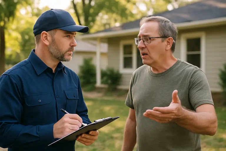
Residents and property owners should separate public infrastructure work from private building requirements. City Development Services flood information in the research record states that homes in FEMA high-risk zones must meet base flood elevation plus one foot, resist hydrodynamic and hydrostatic loads, use flood-resistant materials and elevate critical systems. The same materials state that substantial improvements or substantial damage exceeding 50% of a home’s value can require a building to be brought into compliance.
Those rules matter for residents planning repairs, additions or major renovations in downtown, North Beach, waterfront and other flood-prone areas. A public floodwall project does not remove the need to comply with FEMA/NFIP-related local rules where they apply. Before hiring contractors or setting budgets, property owners should confirm whether the parcel is in a mapped floodplain, whether an elevation certificate is on file and whether the planned work qualifies as a substantial improvement under city rules.
Public Records Residents Can Review
The research record states that the city provides flood maps and property-risk information through its floodplain management tools, including access connected to its Forerunner partnership. Those tools are intended to help owners check risk, floodplain status, elevation certificate information and building or insurance rules. Residents should use those official tools rather than relying on general neighborhood assumptions.
For civic tracking, the practical next step is to monitor City Council agendas, B-Corporation records and project notices tied to the downtown seawall, the museum-area floodwall and the Sam Rankin Street utility work. Residents can also compare local reporting across the same civic-information network, including resources like Saint Joseph Detroit, which provide insight into how infrastructure issues are handled in other communities.
- Check the city’s floodplain tools before starting property repairs or major improvements.
- Review posted agendas and minutes for File #26-1421 and related Type B funding items.
- Ask Development Services how elevation, materials and critical-system rules apply to a specific parcel.
- Watch for city construction notices affecting Sam Rankin Street, museum-area access and waterfront routes.
- Confirm public access changes near the seawall or shoreline through official city project updates.
Corpus Christi Flood Protection Next Steps
The approved work gives residents a clearer record of what changed on September 8, 2026: council authorized major museum-area floodwall design and construction funding, and it expanded the Sam Rankin Street infrastructure allocation. The September 3 File #26-1421 record shows that related seawall, marina and coastal planning items were also part of the city’s public hearing process for fiscal year 2026-27.
Corpus Christi Flood Protection is now best understood as a set of connected public works and regulatory obligations. Downtown residents, business owners and property managers should track both sides of that equation. Public improvements may alter construction zones, waterfront movement and long-term flood defenses. Private projects still must meet applicable floodplain requirements if the parcel and scope of work trigger those standards.
The near-term civic task is documentation. Residents should verify parcel-level flood information, save copies of elevation and permit records, and follow posted meeting materials for construction dates and access changes. That approach keeps decisions tied to official city sources rather than assumptions about when floodwall, seawall, bulkhead or drainage work will affect a particular block.