

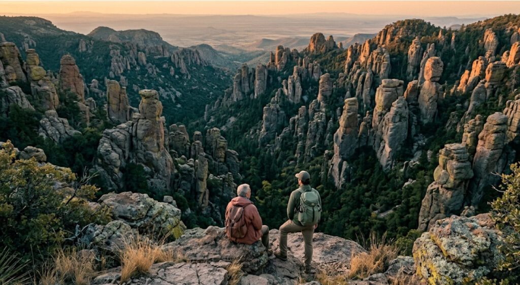
Arizona’s celebrated “Wonderland of Rocks” has entered a new chapter in its history. On October 20, 2026, President Donald J. Trump signed the Chiricahua National Park Act into law, officially redesignating Chiricahua National Monument as Chiricahua National Park. Located in southeastern Arizona near Willcox, the newly designated park protects approximately 12,000 acres of volcanic formations, mountain habitats, wildlife, and cultural history. The change recognizes the site’s national significance while bringing renewed attention to a landscape that has been protected for more than a century. U.S. Secretary of the Interior Doug Burgum said the designation could introduce more visitors to the area and create opportunities for nearby communities. The National Park Service will continue managing the landscape, with conservation, visitor access, and cultural-resource protection remaining central priorities. The National Park Service’s official announcement outlines the redesignation and the features that make this corner of Arizona distinctive.
A New National Park Designation For Arizona’s Wonderland Of Rocks
The redesignation gives Chiricahua a new title but builds on a long conservation history. The area first received federal protection as a national monument in 1924, preserving unusual geological formations and a landscape with deep connections to Indigenous communities and later settlers. More than 100 years later, its elevation to national park status recognizes the importance of protecting those resources while maintaining opportunities for people to experience them.
The legal change followed passage of the Chiricahua National Park Act, H.R. 6380, sponsored by Arizona Representative Juan Ciscomani. Congress advanced the legislation through the 119th Congress before it was signed into law on October 20. The act redesignates the existing monument rather than creating an entirely new park from previously unprotected land. Its boundaries remain those of the former monument as established at the time of enactment.
That distinction matters for visitors and nearby communities. A new designation can increase public recognition, attract travel coverage, and create fresh opportunities for regional tourism, but it does not automatically mean new roads, campgrounds, visitor centers, or expanded boundaries. The National Park Service has said existing opportunities for hiking, camping, scenic driving, wildlife viewing, and other activities will continue.
The immediate change is therefore one of recognition and long-term stewardship rather than a wholesale redesign of park operations. Future investment and visitor demand will determine how the designation affects facilities and services over time.
Volcanic Formations Created Millions Of Years Ago
Chiricahua’s distinctive scenery began with volcanic activity roughly 27 million years ago. An ancient eruption deposited enormous quantities of volcanic material across the region. Over time, cooling, fracturing, erosion, and weathering transformed that material into the towering rhyolite pinnacles, narrow rock columns, and precariously balanced boulders visible throughout the park today.
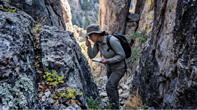
The resulting landscape looks dramatically different from the open desert plains commonly associated with Arizona. Narrow rock passages lead between tall stone formations, while forested slopes and distant mountain views create a changing backdrop along hiking routes. At viewpoints such as Massai Point, visitors can see the scale of the formations and the surrounding valleys that make the Chiricahua Mountains a distinctive feature of southeastern Arizona.
The park’s geological story also gives it scientific value. Rock formations preserve evidence of the region’s volcanic past, while ongoing erosion continues to shape exposed surfaces and individual pinnacles. Protecting the site means managing visitor access carefully so that people can experience the landscape without damaging fragile features or entering unsafe areas.
For park planners, this balance is especially important as national park status raises the profile of the destination. Increased public interest can support conservation awareness, but additional visitors also bring questions about trail conditions, parking, waste management, and the protection of sensitive geological areas.
A Sky Island Where Desert And Forest Ecosystems Meet
Chiricahua is part of the Sky Islands region of southeastern Arizona, where isolated mountain ranges rise above surrounding desert grasslands. Changes in elevation create different temperatures, moisture levels, and growing conditions over relatively short distances. As a result, habitats associated with deserts, grasslands, chaparral, and forests occur within the same broader landscape.
The Chiricahua Mountains rise from the surrounding valleys to elevations approaching 10,000 feet, creating environmental conditions that vary between lower slopes and higher terrain. The National Park Service places the monument’s visitor center at approximately 5,400 feet above sea level and lists Chiricahua Peak at 9,795 feet. Those elevation differences help explain why the region supports such a variety of plants and wildlife.
Birdwatching is a major attraction because the area sits near the meeting point of several ecological regions. Visitors may also encounter mammals, reptiles, and plant communities adapted to changing temperatures and water availability. The park’s combination of rocky terrain, wooded slopes, and open landscapes creates habitat diversity that is unusual within a relatively compact protected area.
Conservation management must account for this ecological variation. Protecting wildlife means considering habitat connections, seasonal conditions, invasive species, fire, and the effects of human activity. As interest in the new national park grows, environmental monitoring and visitor education will remain important tools for keeping recreation compatible with habitat protection.
Chiricahua Apache Heritage Remains Central To The Park’s Identity
Chiricahua’s significance extends well beyond its geology. The landscape is part of the homeland of the Chiricahua Apache, whose history and cultural connections are central to the area’s identity. The National Park Service recognizes the importance of Indigenous history alongside the region’s natural resources and the stories of later homesteading families.
The Chiricahua National Park Act includes provisions concerning the protection of traditional cultural and religious sites. It directs the federal government to consult with tribes in accordance with applicable law and provides for access by tribal members for traditional cultural and customary uses. At a tribe’s request, specific areas may also be temporarily closed to general public use when necessary to protect traditional activities, with closures limited to the smallest practicable area and minimum period required.
These provisions are important because national parks are more than scenic destinations. They can contain places of continuing cultural and spiritual importance to Indigenous communities. Meaningful consultation and appropriate protection help ensure that recreation and public interpretation do not displace those connections.
The area also preserves the history of Faraway Ranch, associated with Swedish immigrants Emma and Neil Erickson and their family. Emma Peterson purchased a two-room cabin in 1886, and the family later expanded the property. The ranch eventually became part of the story of tourism and settlement around the landscape now protected by the park. The National Park Service’s Faraway Ranch history page provides further background on the homestead and its place in local history.
The park’s new name creates an opportunity to tell these histories more fully, including the Indigenous heritage that predates the establishment of the monument and the ongoing relationships between tribal communities and the land.
Hiking, Scenic Drives, Camping And Stargazing Continue
The national park designation does not remove the recreational opportunities that made Chiricahua popular with visitors. The National Park Service identifies approximately 17 miles of hiking trails and an eight-mile paved scenic drive leading toward Massai Point, Echo Canyon, and Sugarloaf. Routes range from relatively easy outings to more strenuous hikes through steep terrain and rock formations.
The scenic drive allows visitors to experience the landscape without undertaking a long hike. Pullouts and viewpoints provide opportunities to stop, observe the formations, and take photographs. Trail users can explore narrow rock passages and overlooks, but should select routes according to their fitness, available time, and weather conditions.
Camping is available at the park’s small, historic campground, which accommodates tents and smaller vehicles by reservation. Chiricahua is also recognized for its dark night skies, making stargazing another attraction for visitors who stay after sunset. The mix of hiking, scenic driving, wildlife observation, and night-sky viewing gives the park several ways to appeal to travelers with different interests.
Visitors should plan ahead. The National Park Service warns that summer heat, intense sun, and unexpected monsoon storms can affect hikes, while colder temperatures and snow are possible during winter. The scenic road is narrow in places, and vehicle-length restrictions apply beyond certain points. Current alerts, trail conditions, and campground availability should be checked through the official Chiricahua park website before travel.
What The Redesignation Could Mean For Nearby Communities
Chiricahua National Park sits near Willcox in Cochise County, a region where outdoor recreation can complement agricultural activity, local businesses, and regional tourism. National park status may increase the destination’s visibility among travelers planning trips through Arizona, potentially benefiting lodging providers, restaurants, guides, and other services in surrounding communities.
Secretary of the Interior Doug Burgum highlighted the possibility of welcoming more visitors and strengthening local economies when announcing the designation. However, the scale of any economic effect will depend on actual visitor patterns, travel spending, and the ability of nearby communities to accommodate demand. The redesignation itself does not guarantee a specific increase in visitation or business revenue.
Local planning will therefore matter. If visitor interest rises, communities may need to assess transportation, accommodation capacity, emergency services, and visitor information. At the park itself, managers will need to balance public interest with the protection of natural and cultural resources. The objective is to make the destination accessible without allowing recreation to undermine the features that prompted its protection.
The park’s existing infrastructure provides a starting point, but any future expansion or major improvements would require planning, funding, and environmental review. Visitors should not assume that the new designation automatically brings additional facilities or changes to access rules.
How National Park Status Fits Into Long-Term Conservation
Chiricahua’s redesignation comes with an opportunity to renew public attention to conservation. Its volcanic formations, varied habitats, cultural sites, and historic structures all require ongoing protection. The new title may help more Americans recognize the area’s importance, but the lasting results will depend on management, resources, research, and responsible visitation.
The National Parks Conservation Association welcomed the redesignation while emphasizing the importance of adequate staffing and funding to protect the site over time. That concern reflects a broader challenge across public lands: recognition can draw visitors, but maintaining trails, protecting habitats, preserving historic resources, and providing visitor services requires sustained support.
The park’s cultural protections also demonstrate that conservation is not limited to scenery and wildlife. It includes safeguarding Indigenous cultural and religious sites, preserving historic resources, and working with communities whose histories are connected to the landscape.
For visitors, the most useful contribution is straightforward: follow park rules, stay on designated trails, carry sufficient water, respect wildlife, and treat cultural and historic sites with care. For public agencies, the challenge is to ensure that growing awareness translates into effective stewardship.
ITPR will continue following developments affecting national parks, public-land access, and conservation programs. Chiricahua’s transition offers a timely example of how a change in designation can bring a distinctive landscape into sharper public focus while leaving the essential work of protecting it firmly in place.