

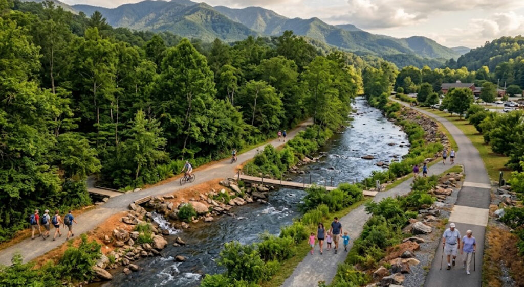
Great Smoky Mountains National Park is moving forward with a new phase of planning for improvements to the 1.6-mile Oconaluftee River Trail, a heavily used pedestrian and bicycle route connecting the park’s Oconaluftee Visitor Center and Mountain Farm Museum with downtown Cherokee, North Carolina. On August 24, 2026, the National Park Service released a Floodplain Statement of Findings and opened another public-review period that runs through September 7. More than 100,000 people use the trail each year, making the project significant for both park visitors and the nearby gateway community.
The proposed work is broader than a routine trail resurfacing project. The National Park Service wants to improve accessibility and trail durability, repair approximately 275 feet of eroded riverbank, replace or repair four existing footbridges, create an accessible riverside viewing area and establish a new trail connection between the park and Saunooke Bridge Road. That proposed connection would link the trail with the sidewalk network on the Eastern Band of Cherokee Indians’ Qualla Boundary.
The project is also being developed in one of the most environmentally sensitive settings in the Smokies. Portions of the trail occupy the Oconaluftee River floodplain, requiring the park to evaluate flood risks and potential impacts before construction can proceed. The latest federal review therefore places recreation access, visitor safety, riverbank protection and environmental compliance within the same planning framework.
A Trail Connecting The Park And Cherokee
The Oconaluftee River Trail occupies an unusual position within Great Smoky Mountains National Park because it functions as both a park trail and a connection to an adjacent community.
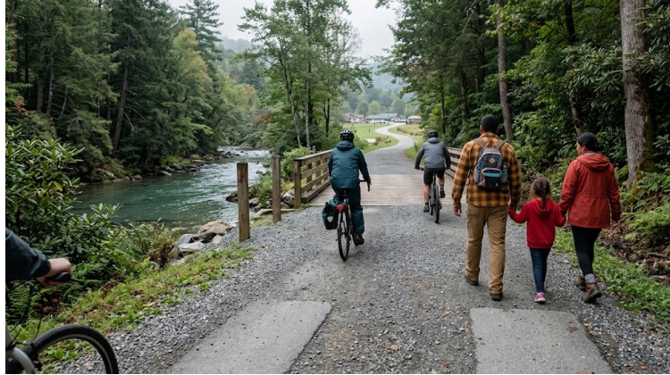
Beginning near the Oconaluftee Visitor Center and Mountain Farm Museum, the route follows the Oconaluftee River toward Cherokee. The park describes Oconaluftee as the southern gateway to the Smokies, directly neighboring Cherokee and the Qualla Boundary. The surrounding valley includes one of the park’s two primary elk herds, along with the visitor center, campground, picnic facilities, riding stable, historic structures and multiple trails.
That setting gives the trail a role beyond conventional recreation.
For visitors, it offers a relatively accessible way to experience the river corridor without committing to a long backcountry hike. For residents and visitors in Cherokee, the route creates a connection into the national park landscape. For the National Park Service, maintaining that connection means managing a transportation and recreation corridor alongside a sensitive river system.
The park estimates that more than 100,000 people use the trail annually. At that level of use, relatively small infrastructure problems can have an outsized effect on visitor experience. A deteriorating bridge, uneven surface or eroding riverbank is no longer an isolated maintenance issue when thousands of people encounter the same feature every month.
The National Park Service is therefore approaching the project as a combination of access, safety, environmental protection and connectivity rather than simply replacing aging trail components.
Proposed Improvements Address Several Problems At Once
The project currently under consideration contains several distinct improvements.
| Proposed Improvement | Primary Purpose |
|---|---|
| Improve trail surface and accessibility | Create a more durable and accessible route |
| Restore approximately 275 feet of riverbank | Address erosion along the Oconaluftee River |
| Repair or replace four footbridges | Improve safety and reliability |
| Build accessible riverside viewing area | Expand access to the river experience |
| Construct spur toward Saunooke Bridge Road | Strengthen connection with Cherokee and the Qualla Boundary |
The earlier public-comment materials released in April 2026 provide more detail about the proposed design. The park considered paving most of the trail while retaining approximately 0.2 miles near the Mountain Farm Museum as gravel. The proposed design would use gravel to establish a level surface before paving, reducing the amount of grading required and helping protect natural and cultural resources.
That approach illustrates the balancing act involved in modernizing trails inside a national park.
A paved surface can improve durability and accessibility, particularly for visitors using mobility devices, bicycles or other equipment. But installing a hard surface in a river corridor also requires careful consideration of drainage, flooding, erosion and landscape impacts.
The proposed riverbank restoration adds another layer.
Approximately 275 feet of eroded bank would be restored using natural streambank-restoration techniques. Rather than treating the river as something separate from the trail, the project recognizes that the condition of the riverbank directly affects the stability and long-term viability of the recreation corridor.
Accessibility Is Becoming A Larger Part Of Trail Planning
Accessibility is one of the most important elements of the proposed Oconaluftee project.
The National Park Service has already identified improved accessibility as one of the project’s primary goals. That is consistent with a broader effort within Great Smoky Mountains National Park to provide more opportunities for visitors with limited mobility.
In April 2026, the park announced its adaptive programming schedule, which included ranger-led hiking, biking and fishing experiences for visitors with limited mobility and their families. One of those programs was an Oconaluftee River Trail hike scheduled for June 20. The park has offered adaptive ranger-led experiences since 2023, working with Catalyst Sports, Knox County and Friends of the Smokies.
The infrastructure project and adaptive programming address different sides of the same issue.
Programming can help visitors discover how to use an outdoor space, but physical infrastructure determines whether that experience is practical in the first place.
A smoother trail surface, improved bridges and an accessible riverside viewing area could allow more people to experience the Oconaluftee corridor without depending on specialized assistance.
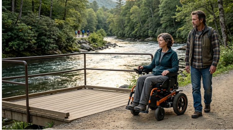
That distinction matters because accessibility in outdoor recreation is not limited to parking spaces or restrooms. Trail grades, surface durability, bridge transitions, viewing locations and connections to surrounding pedestrian infrastructure can all determine how usable a route becomes.
Flood Risk Is Central To The Project
The most recent federal action is specifically tied to the trail’s location within the Oconaluftee River floodplain.
On August 24, Great Smoky Mountains National Park released its Floodplain Statement of Findings for public review. The document evaluates flood risks associated with the project and considers the potential effects of proposed improvements on the floodplain. Public review remains open through September 7, 2026.
This is a critical distinction: the park has not announced a completed construction project.
The current stage remains planning, environmental compliance, design and funding identification. The National Park Service says it will complete the design and compliance processes after considering public input and will then work to identify funding for construction.
That means the final project could still change.
The environmental review process is particularly important because trail infrastructure can influence water movement, erosion patterns and floodplain conditions. Building a trail surface or repairing a riverbank in a flood-prone area requires the park to consider not only today’s conditions but how the infrastructure will respond to future high-water events.
The process also reflects the National Park Service’s broader responsibility to protect natural resources while providing public access.
The Cherokee Connection Could Change How Visitors Move Through The Area
One of the most consequential proposals is a new spur trail connecting the Oconaluftee River Trail to Saunooke Bridge Road.
According to the NPS project documents, the proposed spur would connect trail users with the sidewalk network on the Eastern Band of Cherokee Indians’ Qualla Boundary.
This could transform the trail from a primarily linear park recreation route into part of a larger pedestrian network.
The significance is geographic. Downtown Cherokee sits immediately outside the national park, while the Oconaluftee Visitor Center serves as one of the park’s major gateways. A stronger pedestrian connection between these destinations could make it easier for visitors to move between the community and park without relying exclusively on automobiles.
That has implications for both recreation and gateway-community connectivity.
Visitors staying in Cherokee could potentially reach the park trail more directly. People arriving at the visitor center could have a clearer route toward the community. The resulting network would create more opportunities to combine recreation, cultural tourism and local businesses within a single trip.
The proposal also requires careful coordination because the connection extends beyond the park boundary and into infrastructure associated with the Qualla Boundary.
That makes consultation with the Eastern Band of Cherokee Indians an important part of the planning process.
Cultural Resources Are Part Of The Review
The Oconaluftee area contains significant cultural resources, meaning trail construction cannot be evaluated solely from an engineering or recreation perspective.
The National Park Service’s April project documentation states that continued consultation is expected under the National Historic Preservation Act, including consultation with the Eastern Band of Cherokee Indians, other traditionally associated tribes and the North Carolina State Historic Preservation Office. The project also requires environmental compliance under the National Environmental Policy Act and consultation under the Endangered Species Act with the U.S. Fish and Wildlife Service.
This adds considerable complexity to what might otherwise appear to be a straightforward trail improvement.
A new bridge, paved surface or trail spur can affect archaeological resources, historic landscapes, wildlife habitat and river systems. In a national park, those considerations are part of the project’s basic design process rather than an afterthought.
For visitors, the eventual result may look relatively simple: a smoother trail, safer bridges and a better place to reach the river.
Behind those improvements, however, is a regulatory and resource-protection process designed to ensure that the infrastructure does not compromise the landscape it is intended to help people experience.
Construction Could Begin In Late 2026 Or 2027
The current timeline remains dependent on design, environmental compliance and funding.
The National Park Service previously stated that work on some or all of the proposed improvements could begin in late 2026 or 2027. Once construction begins, the park anticipates a combination of partial and full trail closures, with the overall work estimated to take approximately 12 months.
That projected closure period will be important because of the trail’s high annual use.
With more than 100,000 users each year, even temporary closures could affect visitors planning trips around the Oconaluftee area. The park will need to balance construction access with visitor safety while communicating changes clearly to residents, cyclists, hikers and visitors arriving through Cherokee.
The project is also occurring alongside other infrastructure work within Great Smoky Mountains National Park.
For example, the park announced in August that Abrams Falls Trail would close Monday through Thursday beginning August 24 for construction replacing four aging footlog bridges and handrails and adding stairs at a steep, slick section near Abrams Falls. That project is expected to continue through October 1.
The simultaneous work illustrates the broader maintenance challenge facing a heavily visited national park: infrastructure must be repaired while visitors continue to demand access to the landscape.
A High-Use Trail Becomes A Test For Sustainable Access
The Oconaluftee River Trail project is significant because it brings several competing priorities together in a relatively small corridor.
The park wants to make the route more accessible without losing its natural character. It needs to repair erosion without creating additional impacts to the river. It wants to replace aging bridges while protecting cultural and natural resources. And it wants to improve connections with Cherokee without treating the national park boundary as an obstacle to pedestrian movement.
Those goals are not automatically compatible.
The final design will have to demonstrate that increased access can coexist with floodplain protection and resource conservation.
The September 7 public-review deadline is therefore more than an administrative milestone. It represents another opportunity for residents, visitors, conservation interests and community stakeholders to examine how the proposed improvements fit within one of the Smokies’ most important gateway areas.
For the broader discussion of outdoor recreation access, Oconaluftee offers a useful example of how modern park infrastructure is increasingly being evaluated through several lenses at once: physical accessibility, environmental resilience, visitor safety, community connectivity and cultural-resource protection.
The trail’s future will ultimately depend on what emerges from the remaining design and compliance work, how construction funding is secured and how the National Park Service responds to public input.
What is already clear is the scale of the challenge. A 1.6-mile trail used by more than 100,000 people each year has become a critical link between Great Smoky Mountains National Park and Cherokee. Improving that link means more than making the path easier to travel. It means determining how a heavily used public recreation corridor can remain accessible, safe and environmentally responsible while preserving the river and cultural landscape that make the Oconaluftee area significant in the first place.