

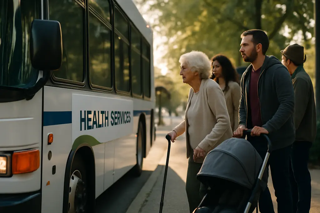
Baltimore Wellness Transit is becoming a practical civic issue as Maryland and Baltimore agencies connect bus priority, station-area planning, pedestrian safety, and access to health services. According to the Maryland Transit Administration, the RAISE East-West Transit Priority Project was announced on September 10, 2026, started construction on October 6, 2026, and is planned to continue through 2029 along a 20-mile corridor served by CityLink Blue and Orange buses MTA project announcement.
Baltimore Wellness Transit Starts With Bus Priority
Baltimore Wellness Transit And Safer Access
The Maryland Transit Administration described the RAISE East-West Transit Priority Project as a $50 million investment supported by a $22 million federal grant. The agency said the work is intended to improve bus travel times, pedestrian safety, lighting, and connections to schools, health care, jobs, and other daily destinations. For residents who rely on buses to reach medical appointments, pharmacies, grocery stores, schools, and workplaces, the official project goals place transportation within a public wellness frame rather than treating it only as a traffic matter.
The project area matters because the CityLink Blue and Orange corridors cross a broad east-west section of Baltimore. MTA’s announcement identified the project as a transit-priority effort, which means the work is focused on making bus movement and rider access more reliable along existing routes. The agency’s stated improvements include safer crossings and better lighting, both of which are relevant for people reaching stops before dawn, after evening appointments, or during shorter winter daylight periods.
Construction had already begun by October 15, 2026, so the most useful public-health reading is not whether the project will begin, but how agencies manage construction impacts while moving toward the planned 2029 completion. Residents, clinic staff, school communities, and employers along the corridor may need clear project notices from MTA as work zones shift. Our earlier local infrastructure coverage of the RAISE construction start gives additional context for the first phase of work.
What The Official Project Links To Wellness
The agency’s public description connects the project to faster trips and safer walking conditions. Those are not abstract benefits for people managing chronic conditions, caregiving schedules, or repeated medical visits. If a bus trip is delayed or a walking route to a stop feels unsafe, a patient may face a longer wait outside, a missed appointment window, or a harder return trip after care. The MTA has not provided health outcome projections in the cited announcement, so any health impact should be described cautiously as a possible access benefit tied to the transportation changes the agency listed.
That distinction is important for evidence-based coverage. A bus-priority project does not, by itself, prove improvements in diabetes control, blood pressure, or emergency-room use. What the official record does show is that Maryland’s transit agency is investing in a corridor where improved access to health care and other daily services is an explicit project purpose. For neighborhood wellness advocates, that creates a measurable civic question: whether transit travel, walking safety, and station access improve enough to reduce access barriers for residents who already depend on these routes.
Station Planning Connects Housing, Services, And Health Access
Transit-Oriented Development Strategy In April 2026
In April 2026, the Moore-Miller administration released the Baltimore Region Transit-Oriented Development Strategy. The Maryland Department of Transportation document describes a regional effort to align land use, infrastructure, housing, jobs, and amenities around existing transit stations, including parks and health services TOD strategy report. This gives Baltimore Wellness Transit a second policy track: not only improving vehicles and corridors, but also shaping what residents can reach near transit stops.
The TOD strategy is relevant to community wellness because access is shaped by both service and location. A frequent bus or rail line is more useful when clinics, grocery options, housing, parks, and job sites are reachable without long transfers or unsafe walks. The official strategy frames station areas as places where public agencies and development partners can coordinate land use and infrastructure. That approach can support health access if future station-area decisions place essential services where transit riders can reach them.
The research notes also identify several related Maryland transit investments in 2026, including new Metro Subway railcars with improved accessibility and passenger comfort, the Rogers Avenue station north parcel development selection, the Light Rail Modernization Program, and the Mondawmin Transit Hub Project. Those details come from official Maryland transportation materials referenced in the research. Because those items are not part of the two cited source links in this article, they should be treated here as supporting context rather than as the main evidence base.
Why Car Access Data Matters For Care
Baltimore City transportation reporting cited in the research notes said that, in 2023, 28.1% of city households lacked access to a car, and 37% of the city’s land area was in census tracts where no-car households were above the city average. Those figures help explain why bus stops, sidewalks, lighting, crossings, and station areas are wellness infrastructure for many households. For residents without a car, transit is often the route to medical appointments, food access, social support, school meetings, and public services.
The city’s Complete Streets work, as described in official materials summarized in the research, also connects transportation design with walking, biking, transit access, ADA compliance, and injury reduction. The reported grants included funding for the RAISE East-West corridor, Penn Station improvements, Mondawmin Transit Hub work, and Safe Streets and Roads for All demonstration projects. Each program has its own scope, but together they show that Baltimore agencies are treating street design as part of public access.
- MTA reported the East-West project as a 20-mile CityLink Blue and Orange corridor investment.
- MDOT’s TOD strategy describes aligning housing, jobs, amenities, parks, and health services near transit.
- Baltimore City transportation reporting cited high no-car household rates, making non-car mobility central to access.
- Maryland health program notes cited community health workers, nutrition education, wellness planning, and transportation barriers in northwest Baltimore.
Health Programs Need Reliable Routes

Northwest Baltimore Wellness Work
The Maryland Department of Health information summarized in the research notes said Healthy Baltimore grantee programs in northwest Baltimore addressed diabetes, heart disease, hypertension, and the disproportionate impact of COVID-19 among Black residents in early 2025. The listed interventions included community health workers, behavioral health support, wellness planning, nutrition education, gardening, yoga and meditation-type wellness services, and attention to transportation and health-care access barriers.
That health-program context is important because transportation barriers can limit participation in exactly the kinds of services public health agencies fund. A resident may know about nutrition education or chronic-disease support but still struggle to reach a session if bus connections are unreliable, stops are far from the site, sidewalks are difficult to use, or evening travel feels unsafe. The official health materials, as summarized in the research, identify transportation as one of the barriers being addressed, which supports a direct connection between transit planning and wellness programming.
This does not mean every transit project automatically improves health outcomes. The more careful interpretation is that transportation improvements can support health programs when they reduce practical access barriers. Baltimore Wellness Transit should therefore be evaluated by what residents can reach: clinics, pharmacies, food resources, schools, job sites, parks, and social services. Readers interested in comparing community health coverage across regions can also explore related local reporting at St. Joseph Detroit.
What Agencies Can Track
For the East-West corridor, public tracking could include construction milestones, bus travel-time changes, stop access changes, pedestrian safety improvements, lighting installation, and ADA-related upgrades. For the TOD strategy, public tracking could include which station areas move into planning or development phases, whether health-serving amenities are included, and whether housing and service access remain part of project criteria. These measures are consistent with the official transportation and TOD goals described by MTA and MDOT.
For health programs, agencies could compare service participation barriers before and after nearby transportation changes, while avoiding claims that transit improvements caused medical outcome changes without supporting data. Community health workers and grantee organizations may be well positioned to document missed-appointment barriers, travel-time burdens, and safety concerns because those issues appear in direct service work. Any future public reporting should distinguish between resident experience, project outputs, and verified health outcomes.
Baltimore Wellness Transit Measures For Neighborhoods
Baltimore Wellness Transit should be assessed through neighborhood-level access rather than only through construction spending. The official record shows a $50 million East-West bus-priority project, a $22 million federal grant for that project, and a regional TOD strategy that names health services among the amenities to be coordinated around transit. The research record also points to city Complete Streets work, no-car household data, and state-supported health programs that address transportation barriers.
For residents and community organizations, the next civic step is to follow agency updates tied to the specific corridor, station, or program that affects their daily travel. Along the East-West project area, that means watching MTA construction notices and asking how temporary work zones affect bus stops, walking routes, lighting, and access to schools or care sites. Around station-area planning, that means reviewing MDOT and local planning materials for whether health services, parks, housing, and jobs remain part of the access discussion.
The public value of Baltimore Wellness Transit will be clearest if agencies report both transportation outputs and access outcomes. Faster bus movement, safer crossings, better lighting, accessible stations, and coordinated station-area planning are meaningful only if they help residents reach care, food, work, school, and social support with fewer barriers. The official plans now give Baltimore a framework to measure that connection through 2029 and beyond.