

Rising Visitor Pressure Across Yellowstone and Grand Canyon National Parks
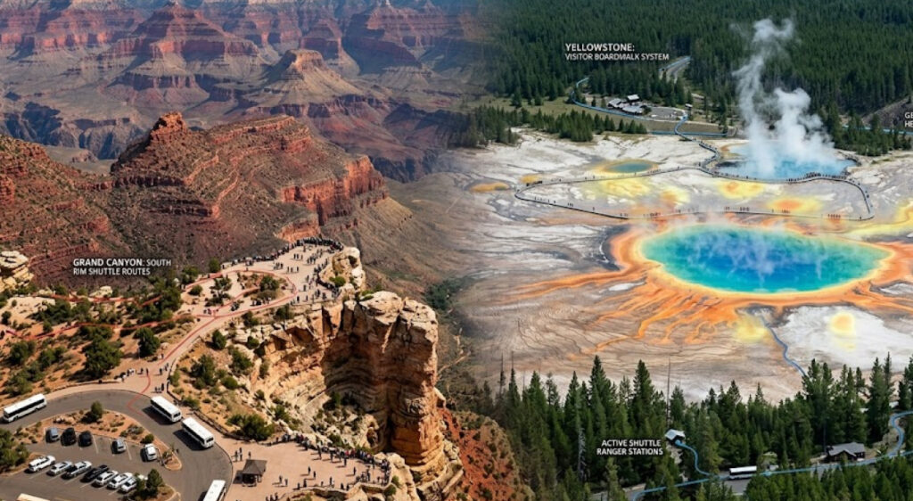
Summer 2026 has placed renewed pressure on visitor management systems across two of the most heavily visited protected areas in the United States: Yellowstone National Park, spanning Wyoming, Montana, and Idaho, and Grand Canyon National Park in Arizona. Both parks continue to operate under increasing seasonal visitation levels, with the National Park Service (NPS) refining access systems, traffic control measures, and real-time communication channels to manage congestion and visitor safety.
The National Park Service (NPS) has been gradually shifting from passive park management toward structured visitor flow systems that rely on reservation frameworks, timed entries in high-traffic zones, and adaptive communication tools. This shift reflects broader federal efforts to balance conservation priorities with sustained public access.
Data from previous peak seasons shows Yellowstone routinely exceeding 4 million annual visitors, while Grand Canyon National Park maintains annual visitation levels above 4.5 million visitors, placing both sites among the most visited national parks in the United States.
The 2026 summer season introduces refined operational strategies shaped by lessons from earlier congestion peaks, wildfire-related closures, and infrastructure strain on key corridors such as Yellowstone’s Grand Loop Road and Grand Canyon’s South Rim access points like National Park Service Visitor Statistics and Reports said.
Yellowstone National Park Traffic Flow Adjustments and Entry Coordination
Yellowstone National Park has continued refining its approach to managing peak-season congestion, particularly along high-density routes such as the West Entrance (West Yellowstone, Montana) and the Northeast Entrance near Cooke City, Montana.
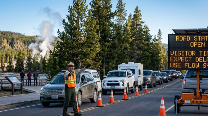
Park management has placed increased focus on distributing visitor flow more evenly across the park’s 2.2 million acres. This includes adjusted messaging for entry timing, improved signage coordination, and real-time updates delivered through official NPS digital platforms.
A key operational shift involves improved coordination between entrance stations and interior junction points, particularly around Old Faithful, Mammoth Hot Springs, and Grand Prismatic Spring, where traffic bottlenecks typically form during midday hours.
Internal park communication systems now integrate predictive traffic modeling to anticipate congestion based on historical seasonal data and current entry rates.
Visitors planning extended trips increasingly rely on structured itinerary planning tools, which are now promoted through state-level tourism platforms such as Wyoming Travel Advisory Services, helping distribute demand across multiple park regions.
A simplified snapshot of visitor pressure distribution across Yellowstone’s primary zones illustrates how congestion varies by region:
| Park Zone | Peak Pressure Level | Primary Cause of Congestion |
|---|---|---|
| West Entrance Corridor | High | Entry bottlenecks and tourism flow |
| Old Faithful Basin | Very High | Geyser timing crowds |
| Lamar Valley | Moderate | Wildlife viewing stops |
| Northern Loop Road | Moderate | Scenic traffic distribution |
These operational patterns reflect ongoing challenges in balancing accessibility with environmental protection in one of the country’s most ecologically sensitive regions.
Grand Canyon National Park South Rim Visitor Management Strategy
At Grand Canyon National Park, the South Rim corridor continues to represent the highest concentration of visitor activity. The National Park Service has maintained and refined traffic and access control measures around key entry points such as Mather Point, Grand Canyon Village, and Desert View Drive.
During the 2026 summer season, visitor communication has placed greater emphasis on staggered arrival times, shuttle usage, and parking management. The free shuttle bus system, operating from the Village Route and Kaibab Rim Route, remains central to reducing private vehicle congestion within core viewing areas.

Communication strategies have also expanded through digital platforms, providing real-time parking availability updates and shuttle tracking features. These tools aim to reduce uncertainty during peak arrival periods and improve distribution across multiple viewpoints along the South Rim.
For broader context on national park transportation systems and sustainability initiatives, the U.S. Department of Transportation outlines federal transit coordination models used in high-density public spaces.
A breakdown of key visitor control mechanisms at Grand Canyon National Park shows the layered structure of current management systems:
| System Component | Function | Impact Area |
|---|---|---|
| Shuttle Transit System | Reduces private vehicle congestion | South Rim corridor |
| Parking Management | Limits overflow at key viewpoints | Mather Point / Village |
| Digital Alerts | Provides real-time visitor updates | Park-wide coordination |
| Entry Guidance Messaging | Distributes arrival times | Gate stations |
These mechanisms reflect a structured approach to maintaining visitor safety while preserving access to one of the most iconic landscapes in the United States.
Communication Systems and Real-Time Visitor Information in NPS Operations
The National Park Service has placed increasing emphasis on real-time communication as a core operational tool across both Yellowstone and Grand Canyon National Parks. Digital alerts, updated road status reports, and mobile-friendly advisory systems now play a central role in shaping visitor behavior before and during park entry.
At Yellowstone, road closures due to wildlife activity or seasonal maintenance are communicated through centralized alert systems, reducing uncertainty at entry points. At Grand Canyon, weather-related advisories and shuttle schedule updates are distributed through coordinated messaging channels managed by park rangers and regional communication teams.
This shift toward real-time communication aligns with broader public-sector strategies documented by the Harvard Kennedy School Government Innovation Program, which highlights the role of digital communication in improving public service responsiveness.
Both parks continue to refine messaging clarity, particularly during peak congestion windows between late morning and mid-afternoon, where visitor decision-making has the highest impact on traffic distribution.
Infrastructure Strain and Seasonal Demand Patterns Across Western National Parks
The 2026 summer season has reinforced long-standing infrastructure pressures across major western parks. Roads, parking facilities, and visitor centers at Yellowstone and Grand Canyon operate near capacity during peak months, requiring continuous adjustments to maintenance schedules and visitor guidance systems.
Seasonal demand patterns show a consistent concentration of visitors during June through August, with weekend surges amplifying congestion effects. Park authorities continue to test adaptive strategies that combine physical infrastructure improvements with communication-based demand distribution.
Public land management studies from the U.S. Geological Survey (USGS) highlight how seasonal visitor patterns directly correlate with environmental stress indicators in high-traffic park zones.
These findings support ongoing policy discussions around sustainable visitation thresholds and long-term infrastructure planning across the National Park Service system.