

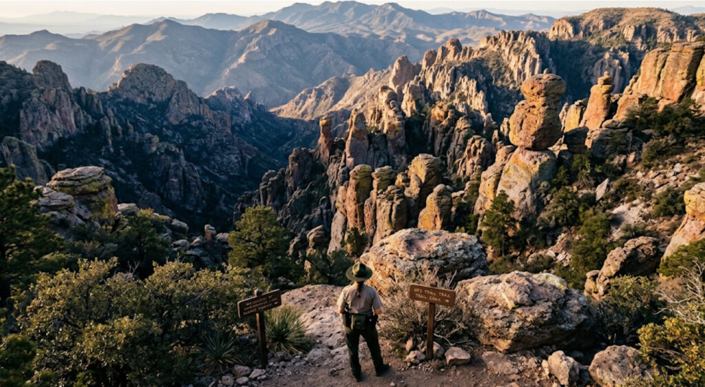
Chiricahua National Monument in southeastern Arizona has officially become Chiricahua National Park, giving the United States its newest designated national park and bringing a century-old protected landscape into a new chapter of its history.
President Donald J. Trump signed the Chiricahua National Park Act into law on October 20, 2026, redesignating the Arizona monument as a national park. The legislation, H.R. 6380, became Public Law 119-133 and changed the unit’s official designation without expanding its boundaries.
Located near Willcox in Cochise County, Chiricahua protects approximately 12,025 acres of volcanic formations, forest, grassland, desert habitats, wildlife areas, wilderness, and historic sites. The landscape is famous for towering rhyolite pinnacles and balanced rocks created after an enormous volcanic eruption approximately 27 million years ago.
The change is significant because Chiricahua is now the 64th officially designated national park in the United States. At the same time, the designation does not represent the creation of an entirely new federal park unit. Chiricahua has been part of the National Park System for decades, first becoming a national monument in 1924.
That distinction matters. The new designation changes the name and national recognition of the landscape, but visitors are not entering a newly constructed park with a different set of basic protections. The National Park Service says the existing management framework continues, while hiking, camping, scenic drives, wildlife viewing, and ranger-led programs remain available.
From National Monument To National Park
Chiricahua’s federal protection began on April 18, 1924, when President Calvin Coolidge established Chiricahua National Monument. At the time, the primary goal was to preserve the area’s unusual rock formations, which became known for their maze of pinnacles and columns.
The landscape had already attracted advocates who believed its geological features deserved greater protection. Among them were Ed Riggs and Lillian Riggs of Faraway Ranch, who helped promote the area and develop trails into what was known as the “Wonderland of Rocks.” Arizona Governor George W. P. Hunt also visited the area in 1923 and supported the effort to establish federal protection.
A century later, Congress approved a different form of recognition.
H.R. 6380, the Chiricahua National Park Act, was introduced by Representative Juan Ciscomani of Arizona and supported by Representative Greg Stanton. The House passed the legislation in March 2026, and the Senate passed it without amendment on September 30. The bill was presented to the president on October 15 and became law five days later.
The legislation’s purpose was straightforward: redesignate the Chiricahua National Monument as Chiricahua National Park.
The federal law did not create a substantially different land base. Instead, it recognized that the landscape’s geological, ecological, historical, and cultural significance warranted the national park designation.
The National Park Service describes the change primarily as one of name and recognition. The agency also emphasizes that the natural and cultural resources receive the same level of protection under the existing National Park Service framework.
A 12,000-Acre Landscape Shaped By Ancient Volcanism
Chiricahua’s most recognizable feature is its collection of enormous rhyolite formations.
The rocks originated from a volcanic eruption roughly 27 million years ago. Layers of volcanic ash and pumice accumulated to extraordinary depths before becoming fused into rhyolitic tuff. Over millions of years, erosion fractured and sculpted the rock into narrow columns, pinnacles, balanced formations, and towering walls.
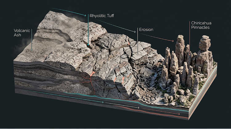
The result is a landscape that looks dramatically different from the surrounding Arizona desert.
The Chiricahua Mountains function as a sky island, where elevations create a meeting point for ecosystems that would normally be separated by much greater distances. Desert scrub and grasslands occur alongside riparian environments and pine woodlands.
That combination helps explain why the area supports such varied wildlife.
The National Park Service lists species including black bears, white-tailed deer, western box turtles, cactus wrens, northern goshawks, banded rock rattlesnakes, turkey vultures, and tiger salamanders among the wildlife associated with the park’s different habitats.
Bird diversity is particularly significant. The Chiricahua Mountains are part of a southeastern Arizona region recognized for its importance to migratory and resident birds. Migrating species traveling between North America and Mexico, Central America, and South America pass through the broader region during seasonal movements.
The new national park designation therefore recognizes more than an impressive collection of rocks. It places greater national attention on a landscape where geology, elevation, wildlife, water, forests, and desert ecosystems interact within a relatively compact area.
The Park’s Boundaries And Wilderness Remain The Same
The redesignation did not expand Chiricahua National Park.
The current park covers approximately 12,025 acres, according to National Park Service statistics. The area has grown considerably since the original 4,238-acre monument was established.
Major additions included more than 6,400 acres added in 1938, the 440-acre Faraway Ranch property added in 1978, approximately 900 acres associated with the Bonita Creek Watershed added in 1984, and 40 acres associated with the Erickson Ranch added in 2014.
The park also contains a substantial wilderness component.
Approximately 86% of the park’s acreage is protected as wilderness, including 9,440 acres designated in 1976 and another 900 acres designated in 1984.
That proportion is important because the national park designation did not arrive alongside a major development program. There is currently no plan for new construction specifically because of the redesignation.
The National Park Service says future projects would continue through normal planning, environmental review, and public involvement processes.
For visitors, this means Chiricahua’s defining character is expected to remain centered on its existing landscape rather than a sudden expansion of roads, buildings, or recreational facilities.
What Changes For Visitors?
For travelers, the most visible change will initially be the name.
The National Park Service is updating signs, publications, web pages, maps, and other materials to reflect the transition from monument to park. Some existing physical signs will remain temporarily while replacement occurs and funding becomes available.
The agency has also confirmed that current fees, permits, and visitor services remain in effect. The redesignation itself does not automatically change entrance or camping fees.
Existing recreational opportunities include hiking, camping, scenic driving, wildlife viewing, birding, horseback riding, and stargazing. The park’s campground remains a relatively small facility, and visitors are encouraged to check current conditions before traveling.
Chiricahua is also relatively close to Interstate 10, making it more accessible than its remote appearance might suggest. The National Park Service describes the park as approximately 45 minutes south of I-10 near Willcox.
The designation could nevertheless change how many people discover the area.
The National Park Service does not currently provide a specific visitation forecast for the redesignation. It does, however, acknowledge that a national park designation can increase awareness and interest.
In 2025, Chiricahua received 70,406 recreation visits. That followed 71,390 visits in 2024 and represented a substantial increase from the 44,794 recorded in 2020.
Whether the new designation pushes visitation substantially above those levels will depend on traveler interest, seasonal patterns, infrastructure capacity, and how effectively the park manages increased attention.
A New National Park With An Old Cultural History
The geological landscape is only one part of Chiricahua’s significance.
The region has deep connections to the Chiricahua Apache, whose homeland encompasses the broader mountain landscape. The park also preserves evidence of later settlement, ranching, conservation, and tourism.
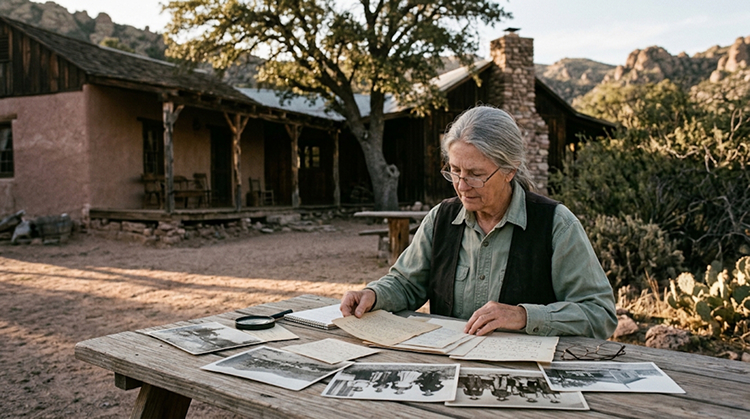
That layered history is one reason the redesignation cannot be viewed simply as a tourism rebranding exercise.
The National Park Service identifies the area as preserving thousands of years of human history, including Chiricahua Apache heritage and the story of homesteading families associated with Faraway Ranch.
Faraway Ranch provides a particularly detailed connection between conservation and tourism.
Emma and Neil Erickson established the ranch in the late nineteenth century. Their daughters Hildegard and Lillian later played major roles in developing the guest ranch operation. Lillian and Ed Riggs also helped build trails and promote the surrounding landscape at a time when formal protection had not yet been established.
The ranch became closely connected with Chiricahua’s emerging tourism economy after the 1924 monument designation.
That history illustrates something that remains relevant today: protecting a landscape can simultaneously create a foundation for recreation, tourism, historical interpretation, and economic activity in nearby communities.
Will The New Designation Increase Tourism In Willcox?
Local economic effects are likely to be one of the most closely watched aspects of Chiricahua’s new status.
Willcox serves as a primary gateway community for travelers visiting the park. Nearby businesses can benefit from visitors who need fuel, lodging, food, supplies, transportation, and other services.
The National Park Service’s available economic data show that Chiricahua already contributes to surrounding communities. In 2017, visitors to the former national monument spent approximately $3.7 million in local gateway communities, supporting an estimated 52 jobs, $1.2 million in labor income, $2 million in value added, and $3.8 million in economic output.
Those figures are older than the park’s current visitation data, so they should not be treated as a measurement of today’s economy. They do, however, establish that visitor spending has long been part of Chiricahua’s economic relationship with the surrounding area.
The new designation could increase that relationship if national park recognition attracts travelers who might previously have overlooked the monument.
Secretary of the Interior Doug Burgum said the redesignation could create opportunities to welcome more visitors and strengthen local economies.
That potential also creates a management challenge.
More visitors can mean more economic activity, but they can also increase pressure on parking areas, trails, campgrounds, roads, wildlife habitat, and other resources. The National Park Service says it will monitor use at locations including Massai Point, Echo Canyon, Bonita Canyon Campground, and parking areas.
The park’s highest traffic periods currently occur in March and during the week between Christmas and New Year’s, according to the NPS.
Protecting The Wonderland Of Rocks Under A New Name
Chiricahua’s transition from monument to national park is therefore less about changing what the landscape is and more about changing how the nation formally recognizes it.
The same rhyolite formations remain in place. The same approximately 12,000-acre boundary remains. The same wilderness areas continue to receive protection. Existing trails, roads, camping opportunities, wildlife habitats, and cultural resources remain part of the park’s management framework.
What has changed is the designation attached to the landscape.
The National Park Service now identifies Chiricahua as America’s newest national park and the 64th officially designated national park.
That distinction gives the area a stronger place in the national park identity familiar to travelers across the country.
It also creates an opportunity to introduce a broader audience to southeastern Arizona’s geology and biodiversity while drawing attention to the area’s Apache history and the people who helped preserve the landscape during the early twentieth century.
For visitors, the transition is unlikely to feel like a completely different park. The experience will still be defined by hiking among towering rock formations, driving through Bonita Canyon, looking for wildlife, watching birds, camping beneath dark skies, and exploring a landscape shaped by volcanic activity millions of years ago.
The difference is that those experiences now carry the name Chiricahua National Park.
The National Park Service has said its commitment to protecting the area’s natural and cultural resources remains unchanged. The immediate task is to manage the transition, update public materials, monitor visitation, and preserve the qualities that made Chiricahua nationally significant in the first place.
For Arizona, the designation adds another nationally recognized destination to a state already known for Grand Canyon National Park, Petrified Forest National Park, Saguaro National Park, and other protected landscapes.
For the National Park System, it adds a 64th national park whose story began more than a century ago.
And for Chiricahua itself, the change represents a new chapter rather than a new beginning. The landscape that visitors now enter as a national park was already being protected, studied, visited, and cared for long before October 20, 2026. The new designation simply gives that remarkable corner of southeastern Arizona a broader national identity.
For more coverage of U.S. public lands, conservation, parks, and related developments, readers can explore national park news and features.